AI-Powered Visuals for Civil Engineers & Planners
Instantly generate high-quality, realistic renderings of your project improvements.

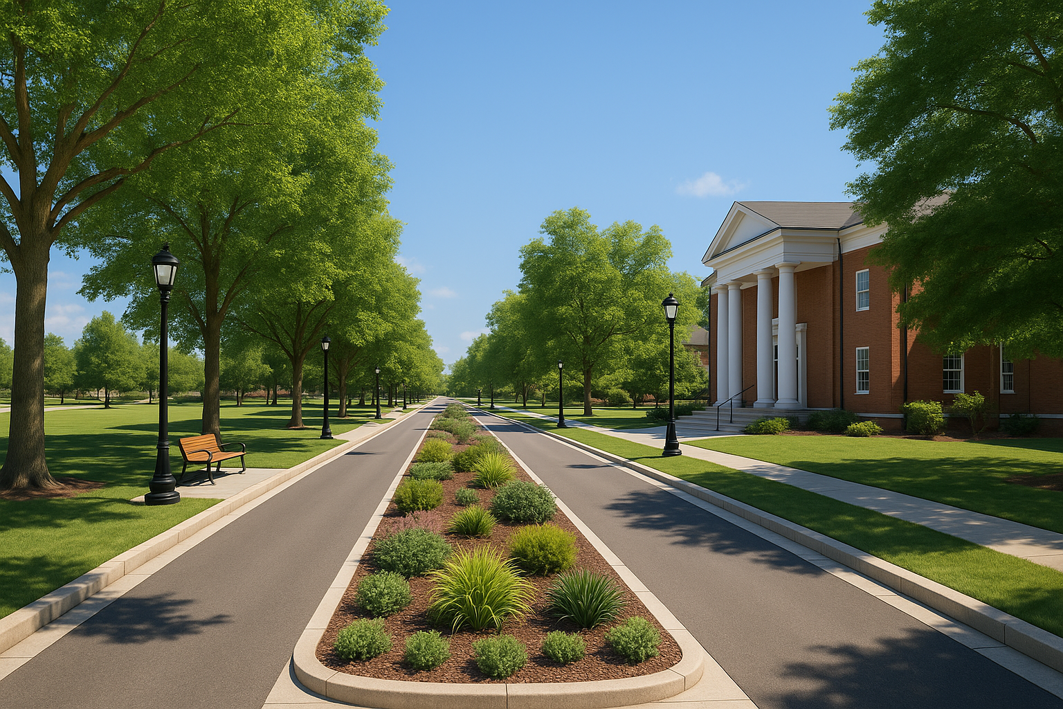
High-Quality Infrastructure Visualizations
Transform your projects with our advanced AI visualization technology
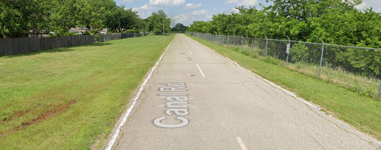
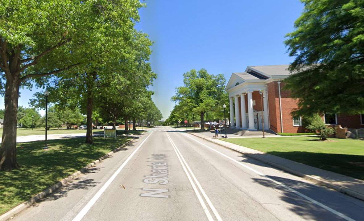
Photorealistic Rendering
High-quality output perfect for stakeholder presentations|
BEFORE
|
AFTER
|
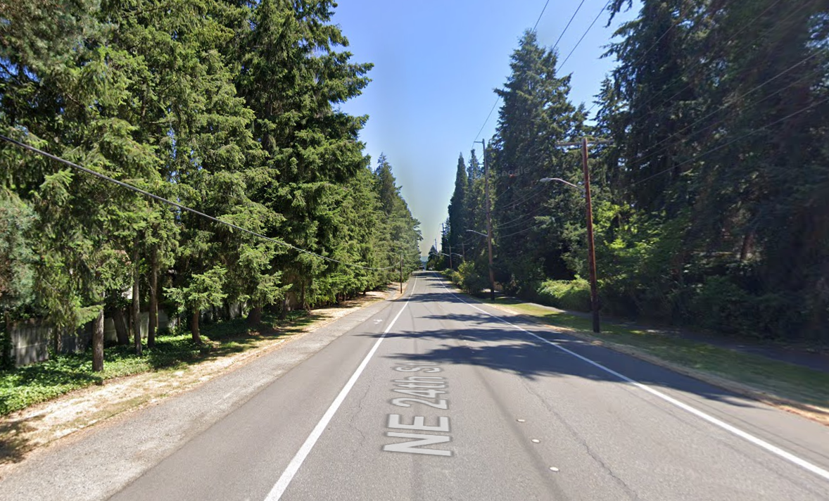
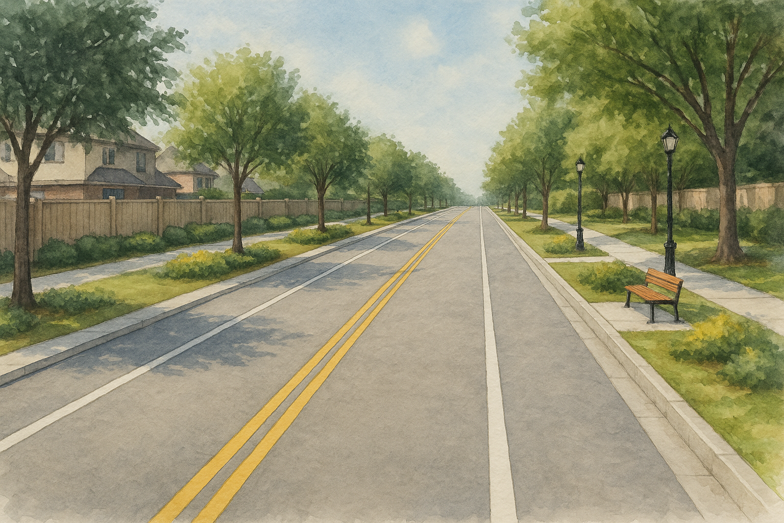
Watercolor Sketch Style
Artistic representation ideal for public engagement|
BEFORE
|
AFTER
|
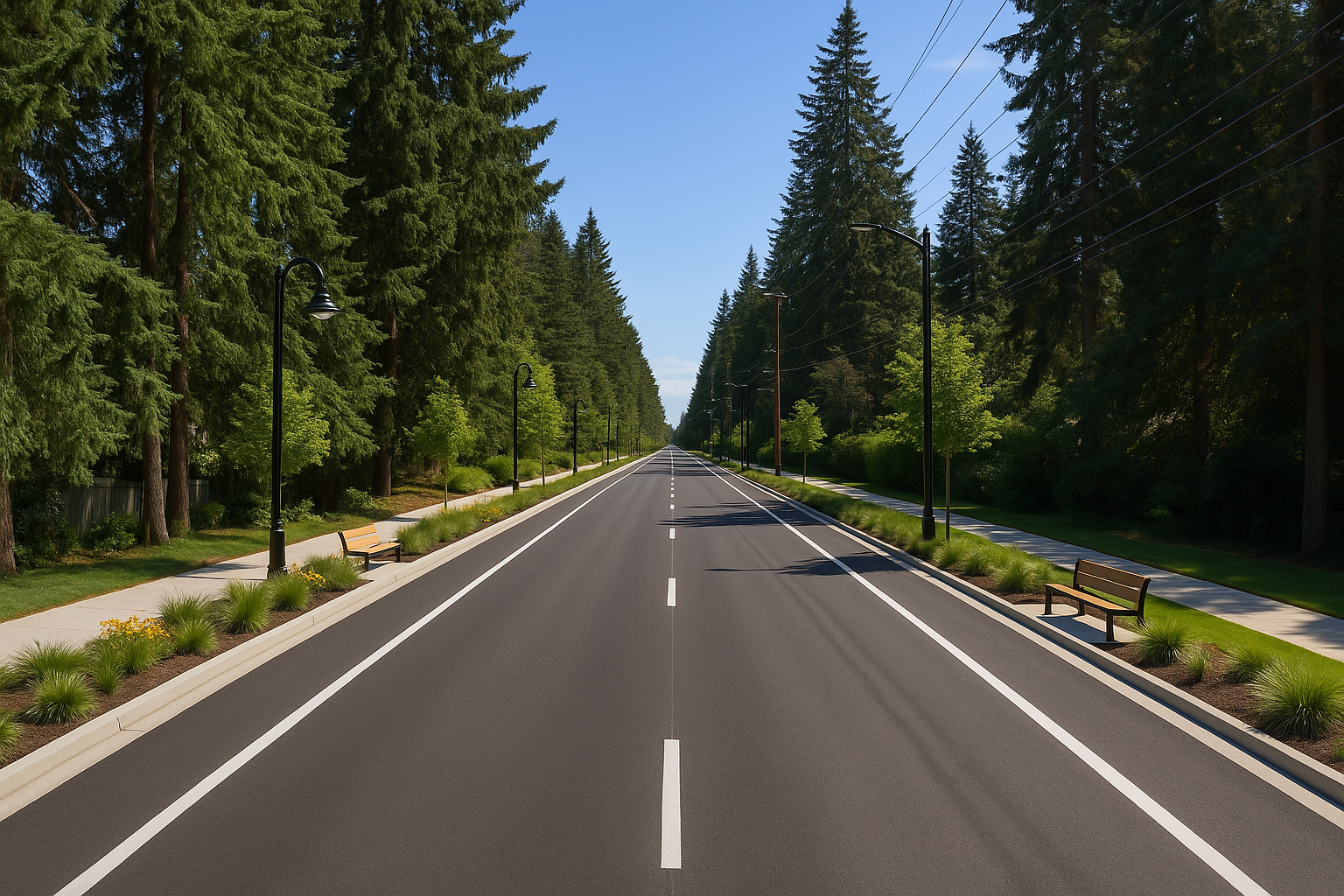
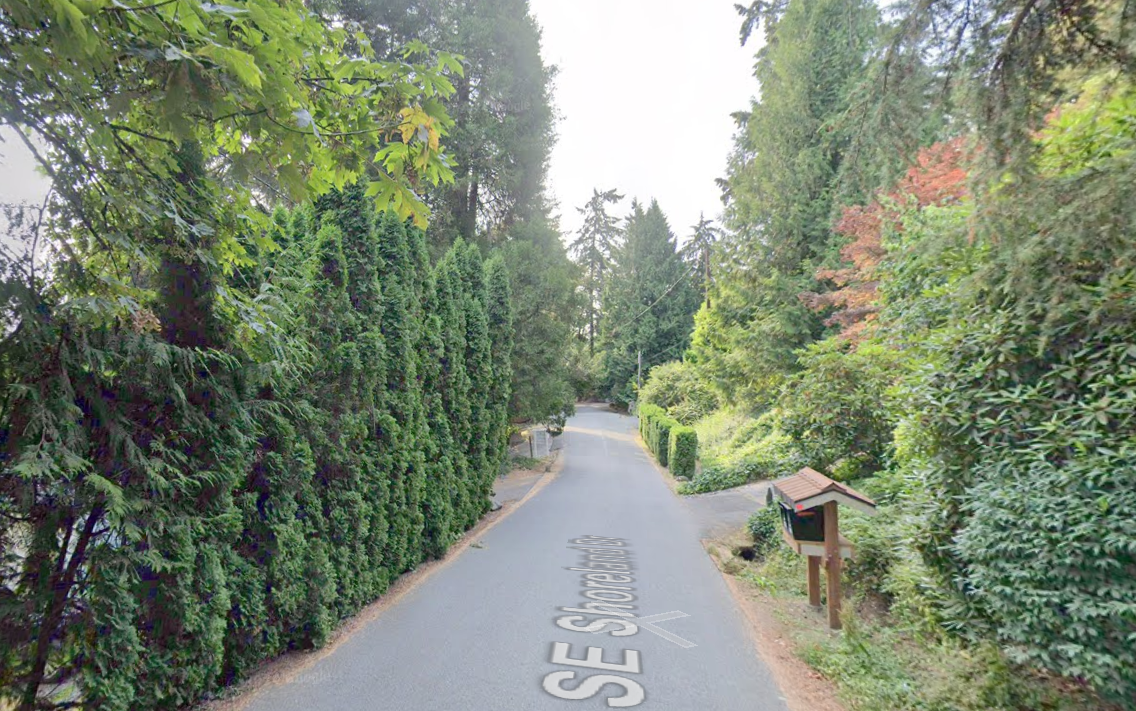
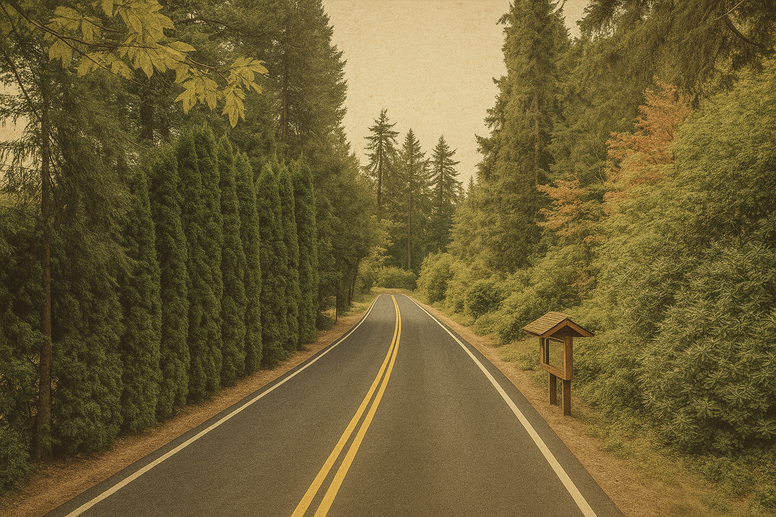
Vintage Postcard Style
Stylized design for community and historical contexts|
BEFORE
|
AFTER
|
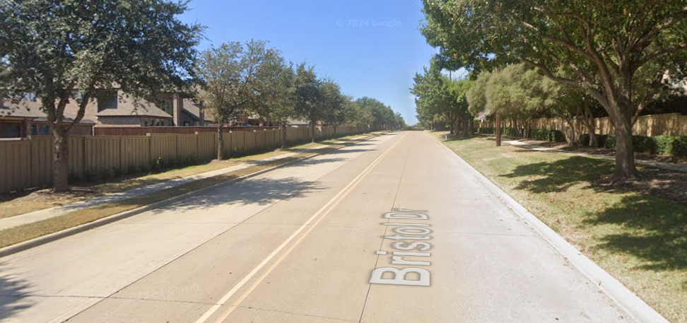
3D Conceptual Rendering
Detailed 3D visualization to illustrate spatial concepts|
BEFORE
|
AFTER
|
How InfraViz Works
Three simple steps to visualize infrastructure improvements
1. Upload Your Photo
Upload any infrastructure photo - streets, intersections, sidewalks, or public spaces - that you want to transform.
2. Select Improvements
Choose from our comprehensive library of infrastructure improvements or provide custom instructions.
3. Get AI-Generated Results
Our advanced AI generates a realistic visualization of your improvements in minutes, ready to download and share.
Why Use InfraViz?
Enhance Stakeholder Communication
Help stakeholders visualize improvements before implementation, improving buy-in and reducing resistance to change.
Save Time and Resources
Generate visualizations in minutes instead of days or weeks of design work, reducing project timelines and costs.
Explore Multiple Alternatives
Quickly create and compare different design options to find the optimal solution for your community.
Build Community Support
Present visually compelling improvements that help secure funding and community backing for your projects.
🔒 Built for Security-Conscious Teams
InfraViz was built with engineering firms and public agencies in mind. We know trust is earned, especially when using AI.
No Sensitive Data Sent
Only the uploaded image and your selected improvements are sent to the model—never any personal or confidential project data.
Not Used for Training
The AI model never trains on your inputs. Your data stays private and is not stored after generation.
Fully Encrypted Processing
All image generation requests are sent over secure, encrypted HTTPS connections.
Role-Based Team Access
Control who can access and edit your projects with robust team permissions.
InfraViz helps you deliver stunning, realistic visualizations—without compromising on security.
Built By Professional Engineers
Built by licensed Professional Engineers who understand the importance of clearly communicating technical improvements to key stakeholders and the general public. InfraViz was built for this purpose.
Example Infrastructure Improvements
Complete Streets
Redesign for all users: pedestrians, cyclists, and drivers
Road Diets
Convert travel lanes to other uses like bike lanes and medians
Roadway Widening
Add new travel lanes to increase capacity and flow
Streetscape Improvements
Add trees, lighting, and urban design elements
Protected Bike Lanes
Add separated bike lanes with physical barriers
Transit Lanes
Dedicated lanes for buses and public transit
Green Infrastructure
Trees, planters, and rain gardens for stormwater management
Pedestrian Safety
Raised crosswalks, pedestrian islands, and curb extensions